Wednesday, December 03, 2008
Wednesday, May 07, 2008
Thursday, December 06, 2007
Tuesday, May 08, 2007
411 Final Project
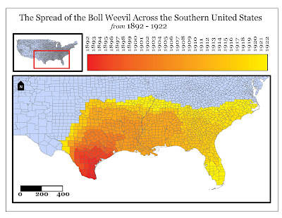
This is my final project for Advanced Digital Cartography. The flash map incorporates many skills we have learned. There are check boxes that give a faux-GIS feel and a streaming video that corresponds to two animations. The scripting was the most difficult part (and most time consuming)... With all of the problems I encountered, it finally came together. (You may need to download flash in order to view this interactive map).
411 Advanced Digital Cartography Final
Click the link below
http://mason.gmu.edu/~cgallow2/411final.html
411 Advanced Digital Cartography Final
Click the link below
http://mason.gmu.edu/~cgallow2/411final.html
Sunday, April 15, 2007
Lab9- SketchUp
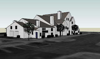
For Lab 9, I used Google SketchUp to create a 3D model of my condo building in Clifton, VA.
http://mason.gmu.edu/~cgallow2/Lab9_2.kmz
or
http://mason.gmu.edu/~cgallow2/Lab9_2.zip
http://mason.gmu.edu/~cgallow2/Lab9_2.kmz
or
http://mason.gmu.edu/~cgallow2/Lab9_2.zip


